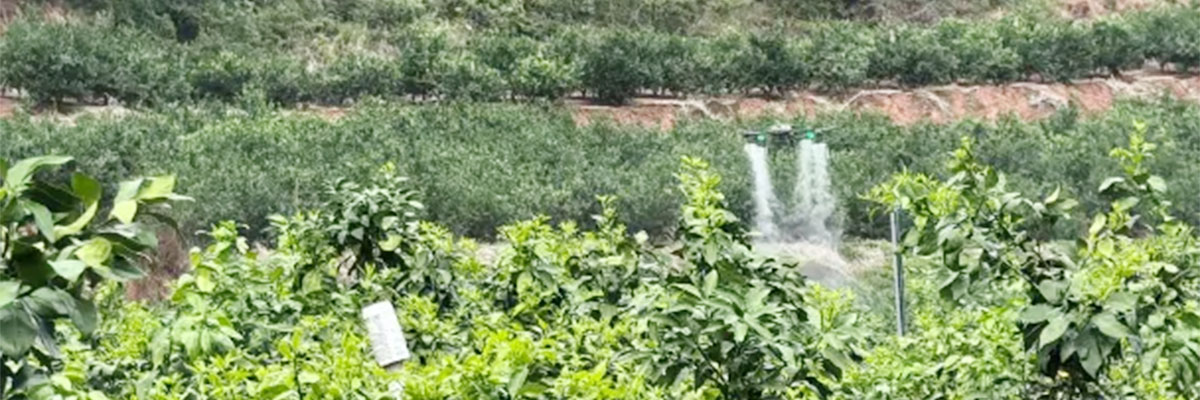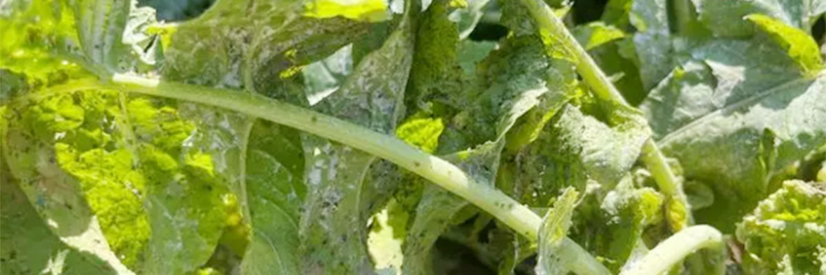
UAVs can carry a variety of remote sensing sensors, which can obtain multi-dimensional, high-precision farmland information and realize dynamic monitoring of multiple types of farmland information. Such information mainly includes crop spatial distribution information (farmland localization, crop species identification, area estimation and change dynamic monitoring, field infrastructure extraction), crop growth information (crop phenotypic parameters, nutritional indicators, yield), and crop growth stress factors (field moisture, pests and diseases) dynamics.
Farmland Spatial Information
Spatial location information of farmland includes geographic coordinates of fields and crop classifications obtained through visual discrimination or machine recognition. The field boundaries can be identified by geographic coordinates, and the planting area can also be estimated. The traditional method of digitizing topographic maps as the base map for regional planning and area estimation has poor timeliness, and the difference between the boundary location and the actual situation is huge and lacks intuition, which is not conducive to the implementation of precision agriculture. UAV remote sensing can obtain comprehensive spatial location information of farmland in real time, which has the incomparable advantages of traditional methods. Aerial images from high-definition digital cameras can realize the identification and determination of basic spatial information of farmland, and the development of spatial configuration technology improves the precision and depth of the research on farmland location information, and improves the spatial resolution while introducing elevation information, which realizes finer monitoring of spatial information of farmland.
Crop Growth Information
Crop growth can be characterized by information on phenotypic parameters, nutritional indicators, and yield. Phenotypic parameters include vegetation cover, leaf area index, biomass, plant height, etc. These parameters are interrelated and collectively characterize crop growth. These parameters are interrelated and collectively characterize crop growth and are directly related to final yield. They are dominant in farm information monitoring research and more studies have been carried out.
1) Crop Phenotypic Parameters
Leaf area index (LAI) is the sum of one-sided green leaf area per unit surface area, which can better characterize the crop's absorption and utilization of light energy, and is closely related to the crop's material accumulation and final yield. Leaf area index is one of the main crop growth parameters currently monitored by UAV remote sensing. Calculating vegetation indices (ratio vegetation index, normalized vegetation index, soil conditioning vegetation index, difference vegetation index, etc.) with multispectral data and establishing regression models with ground truth data is a more mature method to invert phenotypic parameters.
Above-ground biomass in the late growth stage of crops is closely related to both yield and quality. At present, biomass estimation by UAV remote sensing in agriculture still mostly uses multispectral data, extracts spectral parameters, and calculates vegetation index for modeling; spatial configuration technology has certain advantages in biomass estimation.
2) Crop Nutritional Indicators
Traditional monitoring of crop nutritional status requires field sampling and indoor chemical analysis to diagnose the content of nutrients or indicators (chlorophyll, nitrogen, etc.), while UAV remote sensing is based on the fact that different substances have specific spectral reflectance-absorption characteristics for diagnosis. Chlorophyll is monitored based on the fact that it has two strong absorption regions in the visible light band, namely the red part of 640-663 nm and the blue-violet part of 430-460 nm, while the absorption is weak at 550 nm. Leaf color and texture characteristics change when crops are deficient, and discovering the statistical characteristics of color and texture corresponding to different deficiencies and related properties is the key to nutrient monitoring. Similar to the monitoring of growth parameters, the selection of characteristic bands, vegetation indices and prediction models is still the main content of the study.
3) Crop Yield
Increasing crop yield is the main goal of agricultural activities, and accurate estimation of yield is important for both agricultural production and management decision-making departments. Numerous researchers have tried to establish yield estimation models with higher prediction accuracy through multifactor analysis.

Agricultural Moisture
Farmland moisture is often monitored by thermal infrared methods. In areas with high vegetation cover, the closure of leaf stomata reduces water loss due to transpiration, which reduces the latent heat flux at the surface and increases the sensible heat flux at the surface, which in turn causes an increase in canopy temperature, which is considered to be the temperature of the plant canopy. As reflecting the crop energy balance of the water stress index can quantify the relationship between crop water content and canopy temperature, so the canopy temperature obtained by the thermal infrared sensor can reflect the moisture status of the farmland; bare soil or vegetation cover in small areas, can be used to indirectly invert the soil moisture with the temperature of the subsurface, which is the principle that: the specific heat of water is large, the temperature of the heat is slow to change, so the spatial distribution of the temperature of the subsurface during the day can be indirectly reflected in the distribution of soil moisture. Therefore, the spatial distribution of daytime subsurface temperature can indirectly reflect the distribution of soil moisture. In the monitoring of canopy temperature, bare soil is an important interference factor. Some researchers have studied the relationship between bare soil temperature and crop ground cover, clarified the gap between the canopy temperature measurements caused by bare soil and the true value, and used the corrected results in the monitoring of farmland moisture to improve the accuracy of the monitoring results. In the actual farmland production management, field moisture leakage is also the focus of attention, there have been studies using infrared imagers to monitor irrigation channel moisture leakage, the accuracy can reach 93%.
Pests and Diseases
The use of near-infrared spectral reflectance monitoring of plant pests and diseases, based on: leaves in the near-infrared region of the reflection by the sponge tissue and the fence tissue control, healthy plants, these two tissue gaps filled with moisture and expansion, is a good reflector of various radiation; when the plant is damaged, the leaf is damaged, the tissue wilted, the water is reduced, the infrared reflection is reduced until lost.
Thermal infrared monitoring of temperature is also an important indicator of crop pests and diseases. Plants in healthy conditions, mainly through the control of leaf stomatal opening and closing of transpiration regulation, to maintain the stability of their own temperature; in the case of disease, pathological changes will occur, the pathogen - host interactions in the pathogen on the plant, especially on the transpiration-related aspects of the impact will determine the infested part of the temperature rise and fall. In general, plant sensing leads to a deregulation of stomatal opening, and thus transpiration is higher in the diseased area than in the healthy area. The vigorous transpiration leads to a decrease in the temperature of the infected area and a higher temperature difference on the leaf surface than in the normal leaf until necrotic spots appear on the surface of the leaf. The cells in the necrotic area are completely dead, transpiration in that part is completely lost, and the temperature begins to rise, but because the rest of the leaf begins to be infected, the temperature difference on the leaf surface is always higher than that of a healthy plant.
Other Information
In the field of farmland information monitoring, UAV remote sensing data has a wider range of applications. For example, it can be used to extract the fallen area of corn using multiple texture features, reflect the maturity level of leaves during the cotton maturity stage using NDVI index, and generate abscisic acid application prescription maps that can effectively guide the spraying of abscisic acid on cotton to avoid excessive application of pesticides, and so on. According to the needs of farmland monitoring and management, it is an inevitable trend for the future development of informatized and digitized agriculture to continuously explore the information of UAV remote sensing data and expand its application fields.
Post time: Dec-24-2024